
So, some basic facts: California is about 800 miles and, at its widest, about 250 miles wide. However, the shape of the state means one drives diagonally for most of the length - going up the 5 freeway, which runs the whole length of the state, is about 800 miles from the Mexican border to Oregon. For you Europeans, the state is almost the exact same size as the UK.
However, the 5 takes the shortest route: straight up the central valley. While that has its own scenery, a lot of that is through the Central Valley - which means literally hundreds of miles of farms and cattle ranches. While important to the agribusiness of the nation (CA is responsible for something like 10% of the foodstuffs of the US), it's pretty boring.
Much more scenic are the coastal routes - namely, the 101 (which weaves a bit along the coastal mountains) and, more specifically, Highway 1 or the Pacific Coast Highway. In places, Highway 1 and the 101 overlap, but for most of its length, PCH follows the contours of the state. It's this drive that we took for most of its length.
What you see mapped out above is the first day's trip from Pasadena (my humble abode) to Monterey Bay. In "real distance", it's probably less than 300 miles between the two; the route mapped out ended up being almost 400.
 |
| Santa Barbara Mission |
Unfortunately, God apparently likes to sleep in on the weekends and the mission was closed until 9 am, so we didn't get to go inside. They were, however, setting up for some kind of festival outside, including a lot of chalk drawings (none of which were finished). Instead, we hit a Starbucks for some refreshment and got back on the road.
North of Santa Barbara, the 101 follows the coast a bit and then curves inland at Gaviota State Park(1). About here is where PCH and the 101 split for a while, and so we took PCH - here called the Cabrillo Highway, which it was named for most of Saturday's trip - back west a bit. I'd hoped to get to drive closer to Vandenberg Air Force base - they do a lot of test launches and such there - but we were stopped by a rather polite person at a gate and made to go back. Oh well.
North of Vandenberg, PCH winds through the hills and some small towns, meeting up again with the 101 briefly at Pismo Beach (famous for its sand dunes); just past Pismo, we actually jumped off of PCH and cut across on Los Osos Valley Road (no bears were sighted) towards Morro Bay.
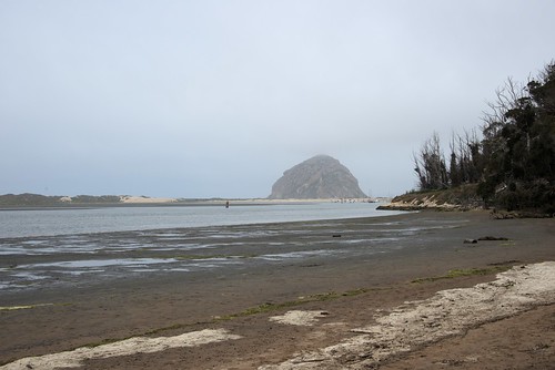 |
| Morro Bay as we approach |
Morro Bay's a cute little town, known for quite resorts and foggy ocean views (as you can see). This shot shows the large rock for which the town is named - mostly likely by Filipino immigrants in the late 1500s (yes, 1500s; Columbus wasn't the only sailor out there, you know).
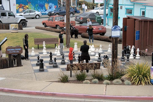 |
| How about a nice game of chess? |
The town itself it a quiet little fishing and tourist village. Most of the resorts are along the coastline just to the north, around the golf course. The most famous is simply called The Inn at Morro Bay.
From Morro Bay, we again joined PCH and continued north, often cutting inland a fair bit before heading back to the coast. This part of California is technically on the Pacific plate; while it's not being subsumed at this spot(and so rumors of L.A. disappearing under the sea aren't very accurate), the constant pressure and slip motion - as well as the motion of the continental plate shifting westward slightly - creates the mountains that not only form the Channel Islands but the hills and such along the coast. California is, in a sense, defined by mountains - and their valleys: on the east, we've got the Sierra Madres that form the temperate barrier along with the Cascades (which are volcanic and of which Shasta, Rainier, Hood and of course Mt. St. Helens are the most famous; the Tehachapis that basically divide Northern and Southern California far more decisively than the cultural war between SF and LA; and tonnes of others. The coastal mountains are simply referred to as the California Coastal Ranges.
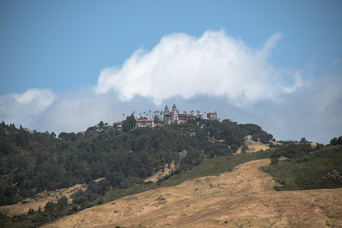 |
| San Simeon from below |
In these coastal ranges, however, nestled a few miles north of Morro Bay above San Simeon Bay, is, well, San Simeon, the famous Hearst Castle. Lambasted in Orson Wells' famous movie "Citizen Kane" as "Xanadu", the property is maintained by a trust(2) that actually owns most of the fields and hills surrounding it. Unfortunately, getting closer involves a tour group and a lot of time we couldn't really spare, so this is as close as we got.
We got a bit closer to some other things, however. Just past San Simeon is a fairly famous spot. My mom says that, 20 years ago, it was just a dirt pull-out along PCH, but now it's a full-fledged parking lot. And there's a reason why it's usually pretty busy:
 |
| They're not dead, they're resting. |
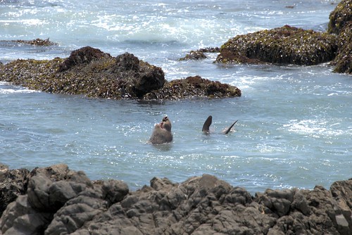 |
| This guy was making a lot of noise. |
Elephant seals regularly relax out on the beaches below PCH. They're noisy and they're smelly, but it's one of the best viewing spots to watch them. And they never seem to mind all of us gawking down on them.
Of course, they weren't the only wildlife there that didn't object to having people around...
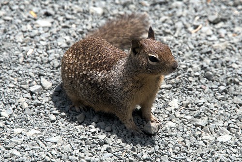
These little guys (and gals) were everywhere.
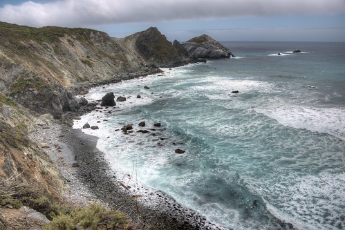
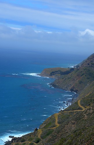
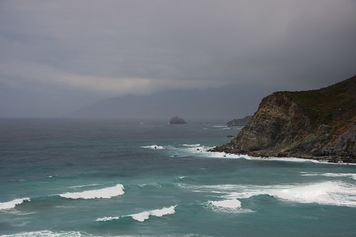
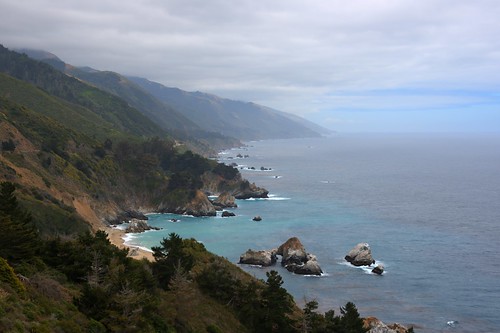
Beyond that, PCH winds its way along miles - and miles and miles - of coastline up towards Monterey Bay. There are basically no towns in between - I think we stopped for lunch as a little dive in Big Sur, which is a camp ground. However, some of the views are impressive, so here's a few shots along the coast.
In Monterey, we hit the Monterey Bay Aquarium. I didn't take my camera inside - there are some things that are better left experienced with both eyes. I'll say no more on that, but if you ever have an opportunity to go there, you should take it - and plan a full day if possible.
After that, we just drove a few miles up the road to the hotel. Dinner at a pub and lights out, because it was another long day of driving to come.
More in the next post, but I'll leave you with a photoshop I did of a photo I took with a caption from a friend on FB.

(1) I'll add a note here, because it came up in conversation. In the US, there are two major groups that manage parks, the federal government (National Parks Service, NPS) and the state (Department of Parks and Recreation, DPR). NPS only handles parks or locations which are deemed of national significance; coincidentally, NPS was founded in order to manage Yosemite National Park in eastern California around 1880. The state handles most other areas, often in conjunction with private groups.
(2) An instance of DPR working with a private group to maintain a property.
1 comments:
Thanks for sharing this terrific travelogue Austin. You make an inspirational travel writer. Reading about your journey makes me want to jump in the car and take a long, slow drive down the PCH myself!
Post a Comment